")
")
The NFI field survey
High quality of the field survey is a prerequisite for achieving the NFI objectives – i.e. to provide unbiased and sufficiently accurate information on the state and changes of forests in the Czech Republic.
Organisation of the survey
Since the second cycle of the Czech National Forest Inventory (NFI2, 2011–2015), both field and photogrammetric surveys have been carried out in each season (spring and autumn) throughout the whole Czech Republic. Within the NFI2, the data were collected in two sampling grids – the NFI1 grid established in the first cycle (NFI1, 2001–2004) and the, by that time new, NFI2 grid. The field survey of the second cycle of the Czech National Forest Inventory (NFI2, 2011–2015) was carried out on 23 199 sample plots, most of which were categorised as forest land.
Since the beginning of the NFI3 (2016–2020), the NFI survey has been conducted using plots of the NFI2 sampling grid only. In addition to the s2a sub-grid prescribed for the field survey in the NFI2 (potentially one field plot in a 2 × 2 km square), additional plots were selected for the NFI3 field survey. These form the s2b sub-grid and were obtained by selecting one additional plot out of the 1 × 1 km sub-grid (s1) in each of the 2 × 2 km blocks (groupings of four s1 plots). The resulting density of the NFI3 field sub-grid is 0.5 plots per one square kilometre and it corresponds to the density of the former NFI1 sampling grid (potentially two plots visited in the field in each of the 2 × 2 km square blocks).
Field survey equipment
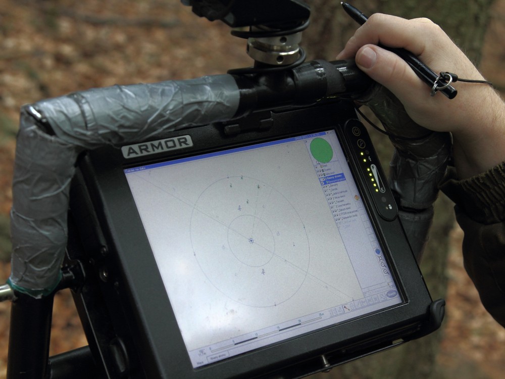
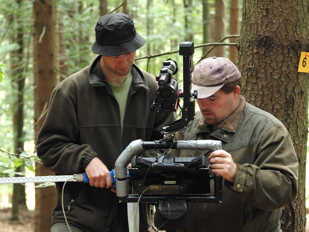
The field data is collected by using the Field-Map Data Collector (FMDC; Ifer, Ltd.) application installed on the field computer. The following devices are connected to the field computer:
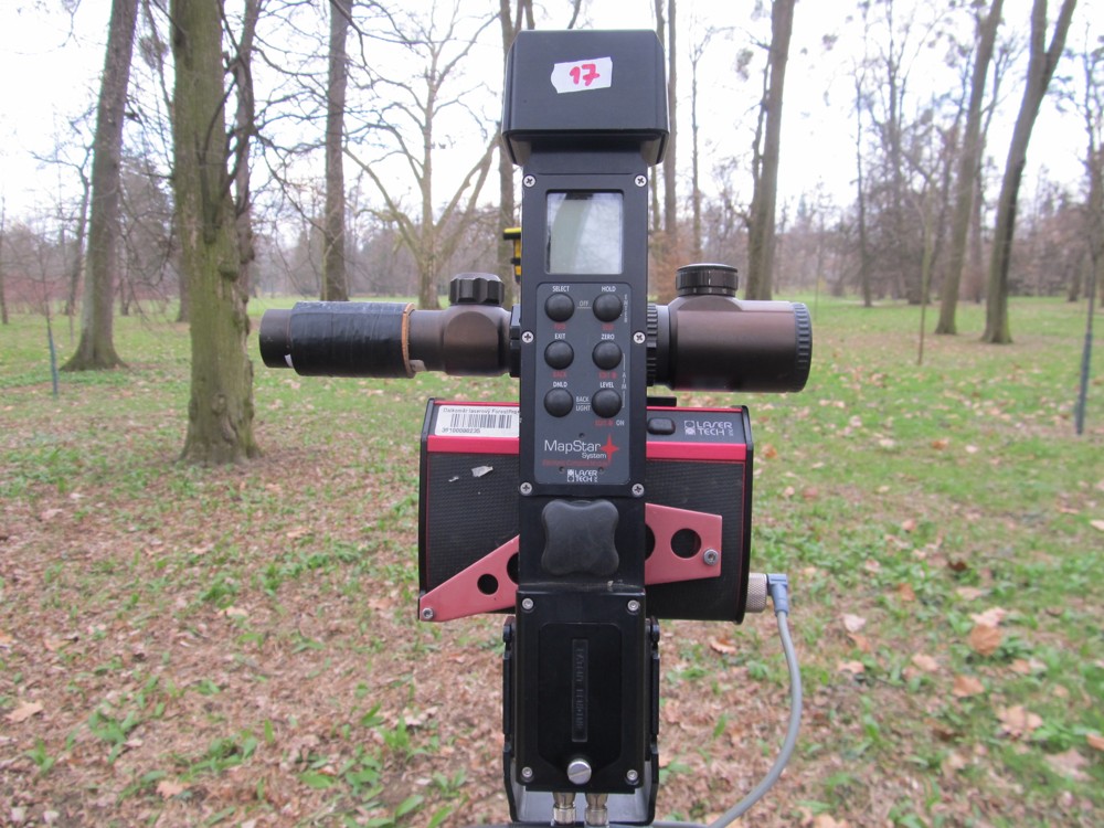
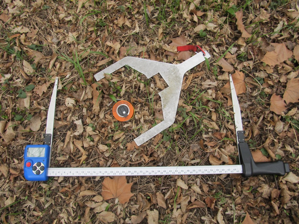
- MapStar electronic compass (Laser Technology, Inc.)
- ForestPro laser rangefinder (Laser Technology, Inc.)
- GPS module (Trimble Pathfinder ProXH)
- electronic calliper (Haglöf)
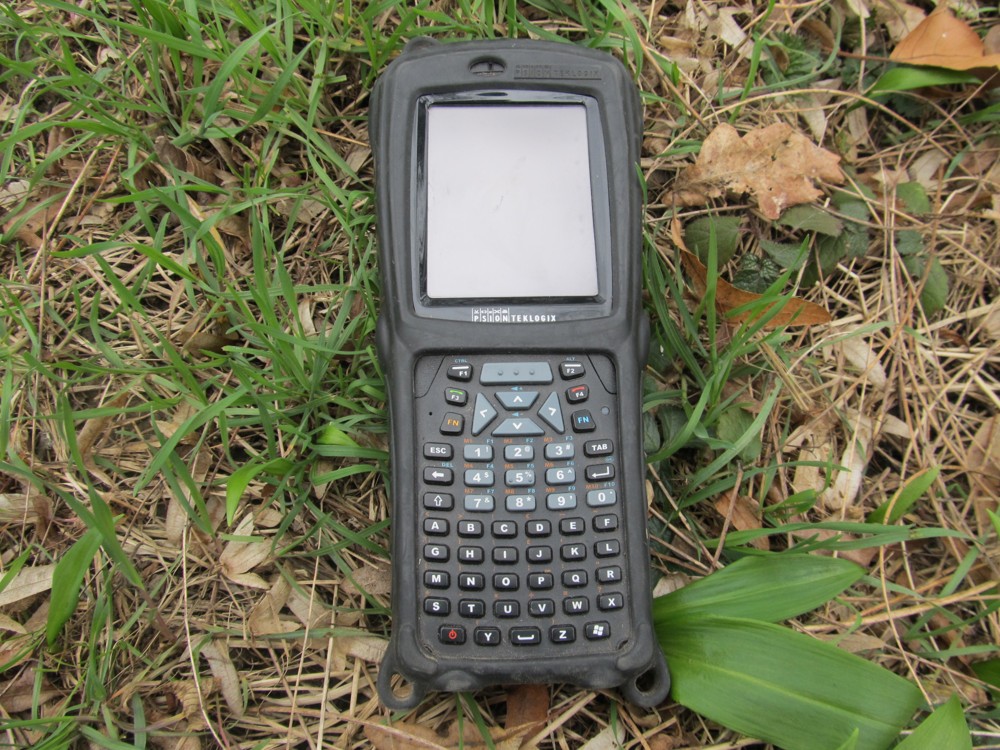
- handheld electronic recorder (Psion)
- camera (Panasonic)
The NFI field teams use also the other, analogue instruments: signalling poles, a tape measure, set of numbers for temporary marking of stems, increment borer, hammer, machete, templates for assessing breast height diameters of border stems, field shovel, folding rule, etc.
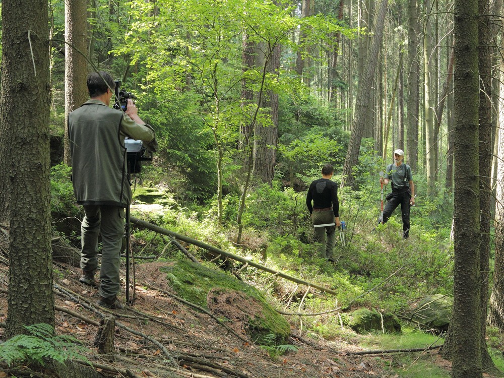
Data collection on sample plots
The field assessment of NFI sample plots is conducted in two successive phases:
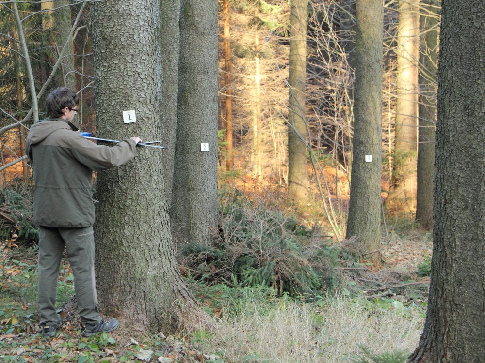
- Navigation to an NFI sample plot – the navigation aims to locate the centre of a sample plot visited during the previous inventory campaign or to establish a new plot (on land which was not classified as one of the target land categories, i.e. Forest, OWL or ToL during the previous inventory but has been pre-classified as such by remote sensing in the current campaign). During the navigation work the GPS module, the laser rangefinder and the electronic compass are used. The position of the plot centre established in one of the previous NFI cycles is recovered by using a metal detector (positions of plot centres are fixed by metal sticks). As the next step, auxiliary navigation points (easily noticeable, unequivocally identifiable permanent objects around a sample plot) are mapped. These auxiliary navigation objects can be used to track the plot centre stabilisation repeatedly or to restore the positional situation within a sample plot (in terms of individual sample stems positions). For more detailed information about the process, see the NFI1 navigation chapter within the NFI field instructions manual (in Czech).
- Assessment of sample plots – after the plot centre has been successfully found or newly established, the sample plot survey proper is carried out. It involves the following operations:
- description of the plot centre
- classification of the interpretation square according to accessibility and land categories
- description of site conditions
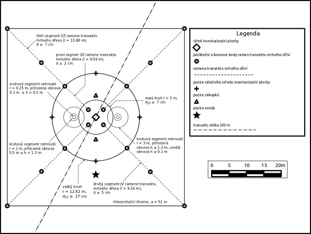
- description of the large circle, focused on forest stand attributes
- mapping and description of stems above the general callipering threshold (dbh 7 cm or more)
- registration and description of stems below the 7 cm dbh threshold but higher than 10 cm
- description of soil properties using two sample locations, extended by a deep soil pit on a subset of sample plots (the s4 sub-grid, one plot per a 4 × 4 km square) from which samples for laboratory analysis are taken
- assessment of lying dead wood on four corners, each one going to one corner of the interpretation square
- assessment of linear, point and areal objects using a randomly oriented, 300 m long transect line centred at the plot centre position
- final data quality, i.e. plausibility, completeness and integrity check
The extent and structure of data collected on sample plots belonging to the particular NFI sub-grid is being regularly (but only slightly) adjusted before each NFI cycle, depending on the actual needs and considering the NFI cost efficiency. Detailed descriptions concerning the NFI field survey can be found in working instructions published for each NFI cycle separately.